
In this investigation, students will locate areas where heat escapes from the Earth’s interior and provide evidence for a hot mantle. They will:
- Investigate how surface heat flow (loss) is distributed around the Earth and its relationship to plate boundaries.
- Discover geologic features on the Earth’s surface that are associated with heat loss.
- Prior to implementing this learning activity, make sure that students have some prerequisite knowledge about sea floor spreading, hotspots, and convection currents. These concepts are explored in more detail in this investigation.
- We recommend that you read the How does thermal energy move around the Earth? Teacher Guide prior to implementing this investigation. The Teacher Guide contains additional content and pedagogical support materials that are not described on this Web page.
1. Begin the class by asking students to respond to the following in their journals: How does thermal energy move around in the Earth?
2. Inform students that they will learn to use a GIS to learn about thermal energy in the Earth using surface heat flow, bathymetry, and ocean floor age data.
3. Use an LCD projector to display the Web GIS to the front of the room. The Web GIS will open to a map with a global view and the Surface Heat Flow layer turned on.
4. Distribute the How does thermal energy move around in the Earth? Student Guide and Investigation Sheet to each student. Instruct students to follow the directions outlined in their guide.
5. Instruct students to go to: https://eli.lehigh.edu/learners/tectonics and click on How does thermal energy move around in the Earth?
6. Model how to use the Map Legend tab to interpret this data layer. The colors on the Surface Heat Flow layer represent the heat released from the Earth’s interior at that location in milliwatts of heat energy per square meter.
7. If needed, provide an orientation of the Web GIS layout and tool features to your students. In the first step, students need to navigate around their maps to make interpretations and answer questions. We recommend that you show students how to zoom-in and zoom-out to a location using the GIS navigation bar in addition to the Map Navigation Tools, how to navigate around the map, and identify the cursor's geographic location (latitude and longitude). Show students how to click on Hide Tools to remove the toolbars menu from the GIS. They can then click Show Tools to display the toolbars menu again.
8. Have students begin the investigation, complete all data charts and answer the questions on their investigation sheets. Provide guidance to students as needed.
9. Before students start Step 3, model the Swipe Tool and the Elevation Profile. First, using the Swipe Tool, show students how to activate the divider and click and drag to compare layers. Next, model how to interpret the Elevation Profile by showing how points on the profile graphic display correspond to locations on the Web GIS. Also, show your students how to draw a profile across the Mid-Atlantic Ridge.
Implementation suggestion:
- We recommend that you explicitly model how to interpret an elevation profile graph from a profile line drawn on the map.
- Reading an Elevation Profile: All elevations below sea level will be negative numbers, while elevations above sea level will be positive numbers. Sea level is at 0 meters elevation. A deeper sea floor elevation corresponds to a higher negative number. A shallower sea floor elevation corresponds to a lower negative number.
- A point on an elevation profile at – 3000 meters means that the elevation of the sea floor at that point is 3000 meters below sea level. Likewise, a point on an elevation profile at – 1000 meters means that the sea floor elevation at that point is 1000 meters below sea level. -3000 meters is deeper than -1000 meters.
- Some students may require additional scaffolding to interpret the age of the ocean floor in the elevation profile display for item #7 on the Investigation Sheet. We suggest you start at the Mid-Atlantic Ridge to first identify the age of the ocean floor with your students. Next, note to students that the age of the ocean floor is symmetrical as it moves away from the Mid-Atlantic Ridge.
10. Review and discuss aloud student responses to key questions on their Investigation Sheets. Ask students if they have any questions about concepts covered in the lesson and respond to their questions.
Implementation suggestion:
- For classes with students with special needs, you may wish to provide additional modeling, prompts and guidance as students work through the investigation. You may wish to explicitly model each procedural step with the Web GIS using a projected image before the students work independently or in pairs to complete the learning tasks.
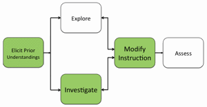
11. If students at the completion of the activity do not understand that surface heat flow is greatest at divergent boundaries, and that age and elevation of the surface are related to heat flow, modify instruction as needed to ensure students understand these concepts.
12. To provide closure to this investigation, have students reflect on what they have learned about thermal energy in the Earth and discuss their responses. Here are some suggestions:
Provide students with a reflective question to respond in their journals about tectonics. For example:
a) Why do plate boundaries release more of the total thermal energy from the Earth than hotspots?
b) What is the relationship between elevation, age, and surface heat flow?
Materials Needed:
Handouts
(1) How does thermal energy move around the Earth? Teacher Guide (PDF / MS Word)
(2) How does thermal energy move around the Earth? Student Guide (PDF / MS Word)
(3) How does thermal energy move around the Earth? Investigation Sheet (PDF / MS Word)
Web GIS
Assessment Information
How does thermal energy move around the Earth? Assessment (PDF / MS Word)
Teacher Resources/Content Support
Web GIS Investigation 3 Tutorial (QuickTime Video)
Web GIS Features Overview (QuickTime Video)