 |
|
|||||||
| |
|||||||
| [ Main ] | Educator's Guide | ||||||
|
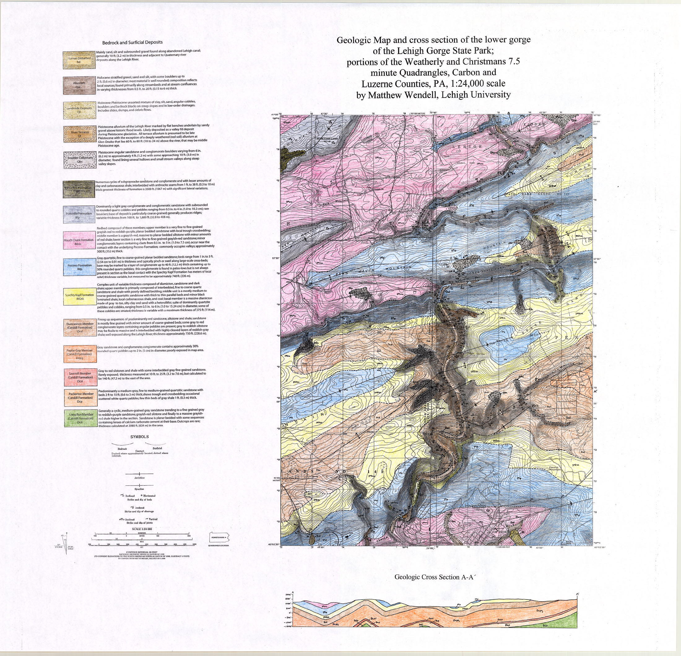
M a p s
|
||||||||||||||
|
| ||||||||||||||
|
Lehigh Gorge Digital Shaded
Relief Map
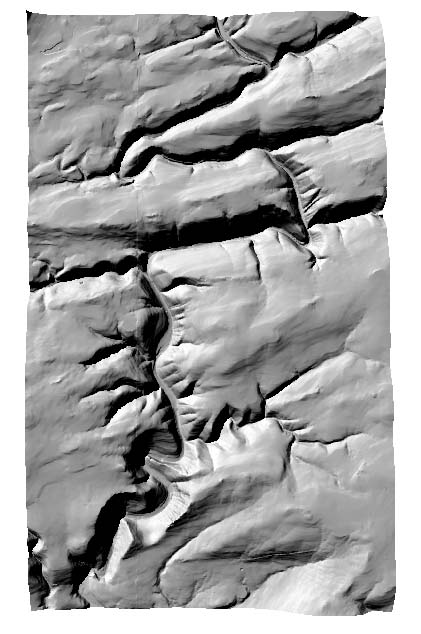 |
Click Map to Enlarge
|
||||||||||||
| | Lehigh Gorge Home | Maps | Pictures | Stratigraphy | Labs | Trail Guide | | ||||||||||||||
|
|
LEO EnviroSci Inquiry
is brought to you by LEO and the
SERVIT Group at Lehigh University
Copyright ©2000-2005 LEO and the SERVIT Group at Lehigh University. All rights reserved. |